


£ 27.14

Sponsored links
|
|
£ 27.14 |
To Shop
|

|
£ 33.99 |
To Shop
|
| COMPARE ALL WEBSHOPS (2) | ||
 Description
Compare webshops (2)
Sponsored links · Some shops pay us a fee
£ 27.14
£ 33.99
Shops with other sizes
Description
(1)
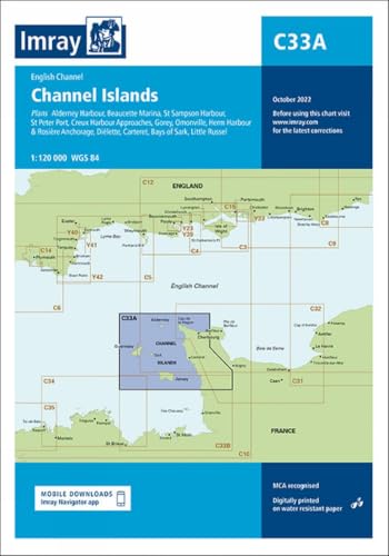
Imray North Of Channel Islands Marine Charts. Imray Chart C33A: North of Channel Islands | Detailed Marine Navigation ChartNavigate the challenging and beautiful waters of the Northern Channel Islands and the adjacent French coast with the unparalleled clarity and reliability of the Imray Chart C33A. Designed specifically for the leisure mariner, this chart is an indispensable tool for safe passage planning and detailed pilotage in this popular Western Europe cruising ground. Whether you are a seasoned sailor or a motorboat skipper exploring the region for the first time, the C33A provides the confidence you need to tackle complex tides, intricate passages, and busy harbours.Based on official data from the UK Hydrographic Office (UKHO), this chart is meticulously produced by Imray, a name synonymous with quality cartography for over a century. The distinctive Imray colour palette and clear symbology make it easy to distinguish between deep water, drying areas, and navigational aids at a glance, reducing cognitive load and enhancing situational awareness, especially in demanding conditions. Printed on durable, water-resistant Pretex paper, the C33A is built to withstand the rigours of life on board, resisting spray and frequent handling. This chart is an essential component of any vessel´s navigation suite, serving as a vital primary reference or a crucial backup to electronic chartplotter systems.Key Benefits:* Superior Clarity: Utilises Imray´s renowned colour scheme for instant recognition of depths, hazards, and navigational features, ensuring quick and accurate interpretation.* Comprehensive Coverage: A single sheet combines a large-scale passage chart with numerous detailed harbour and approach plans, eliminating the need for multiple charts and offering exceptional value.* Enhanced Safety: Features up-to-date information derived from official UKHO surveys, including detailed tidal stream data with diagrams and tables, to ensure the safest possible transit through these tidally complex waters.* Exceptional Durability: Printed on high-quality, water-resistant paper that can be folded and handled repeatedly without tearing or smudging, making it perfect for use in an open cockpit or at the chart table.* Authoritative Data: Meticulously compiled and edited by Imray´s expert cartographers, providing a trusted source of information for your voyage.Main Features:* Passage chart covering Alderney, Guernsey, Herm, Sark, and the adjacent coast of France.* Includes detailed plans for key harbours and anchorages.* Tidal stream diamonds and tidal stream diagrams are shown on the chart.* All data is based on the latest official hydrographic surveys.* Clear, logical layout of plans for ease of use.* Latitude and longitude grids are provided for GPS positioning.* World Geodetic System (WGS) 84 datum is used throughout.Detailed Plans Included:* The Swinge (1:50.000)* Alderney Harbour (1:12.500)* Little Russel (1:25.000)* St Peter Port (1:12.500)* Beaucette Marina (1:12.500)* Gouliot Passage (1:25.000)* Port de Diélette (1:20.000)* Port de Carteret (1:30.000)* Les Héaux de Bréhat (1:50.000)Technical Specifications:* Chart Number: C33A* Title: Channel Islands (North)* Publisher: Imray, Laurie, Norie & Wilson Ltd* Publication Date: Latest Edition* Data Source: UK Hydrographic Office (UKHO)* Main Scale: 1:150.000* Datum: WGS 84* Material: Pretex water-resistant paper* Dimensions: A2 (594x420 mm)* Region: Western Europe. tradeinn Waveinn
 Product specifications
| Brand | Imray, Laurie, Norie & Wilson Ltd |
|---|---|
| EAN |
|
| Color |
|
| Size |
|
| Gender |
|
 Price History
 * Price history contains no data from Amazon.
Prices were last updated on:
 Related results


