A Z Leeds Street Map 46.75" x 36.25" Paper

|
£ 45.99 | To Shop |
 Description
Amazon
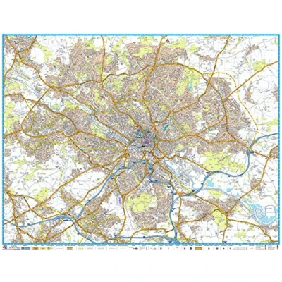
46.75 x 36.25 inches. Printed on paper. Flat Map, tubed for shipping. A-Z Street Map of Leeds. This map covers Alwoodley, Beeston, Birkenshaw, Birstall (part), Bramley, Calverley, Colton, Cross Gates, Drighlington, Farsley, Gildersome, Harehills, Headingley, Horsforth, Leeds, Meanwood, Middleton, Morley, New Farnley, Oulton, Pudsey, Rawdon, Rothwell, Roundhay, Scholes, Swillington, Thorner, Woodlesford, Wortley, Yeadon (part). First edition, published August 2016. Maps created by A-Z Maps, the publisher of the United Kingdom's iconic street maps Scale 1:15,840


Compare webshops (1)
46.75 x 36.25 inches. Printed on paper. Flat Map, tubed for shipping. A-Z Street Map of Leeds. This map covers Alwoodley, Beeston, Birkenshaw, Birstall (part), Bramley, Calverley, Colton, Cross Gates, Drighlington, Farsley, Gildersome, Harehills, Headingley, Horsforth, Leeds, Meanwood, Middleton, Morley, New Farnley, Oulton, Pudsey, Rawdon, Rothwell, Roundhay, Scholes, Swillington, Thorner, Woodlesford, Wortley, Yeadon (part). First edition, published August 2016. Maps created by A-Z Maps, the publisher of the United Kingdom's iconic street maps Scale 1:15,840
 Product specifications
 Price History
Prices were last updated on:
 Related products
 To Shop


