West Midlands Postcode Sector Wall Map (S10) 47" x 33.25" Laminated
Prices from
COMPARE ALL WEBSHOPS
(1)
Amazon
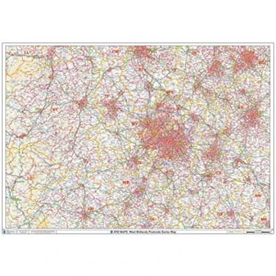
47 x 33.25 inches. Laminated. Flat map, tubed for shipping. The West Midlands Postcode Sector Wall Map shows detailed postcode sector boundaries along with its associated label (B1 1, B1 2) on a comprehensive background and is perfect for determining postcode boundaries, for sales, logistics, planning mailshots or as a regional reference guide. Map created by XYZ Maps, one of Scotland's leading map publishers. Scale 1:150,000
Read more
63.99
Featured

|
£ 63.99 |
To Shop
|
 Description
Amazon
47 x 33.25 inches. Laminated. Flat map, tubed for shipping. The West Midlands Postcode Sector Wall Map shows detailed postcode sector boundaries along with its associated label (B1 1, B1 2) on a comprehensive background and is perfect for determining postcode boundaries, for sales, logistics, planning mailshots or as a regional reference guide. Map created by XYZ Maps, one of Scotland's leading map publishers. Scale 1:150,000


Compare webshops (1)
Shop

Price
47 x 33.25 inches. Laminated. Flat map, tubed for shipping. The West Midlands Postcode Sector Wall Map shows detailed postcode sector boundaries along with its associated label (B1 1, B1 2) on a comprehensive background and is perfect for determining postcode boundaries, for sales, logistics, planning mailshots or as a regional reference guide. Map created by XYZ Maps, one of Scotland's leading map publishers. Scale 1:150,000
 Product specifications
 Price History
Prices were last updated on:
 Related products
Featured Choice
£ 63.99


