Greater London Postcode Sector Map 8 Wall With Motorway, A' Roads, B' City Plans, Area, District, Sectors Size: 73 x 107 cm (29 42 inches) Scale: 1:60 000 Laminated

|
£ 29.99 | To Shop |
 Description
Amazon
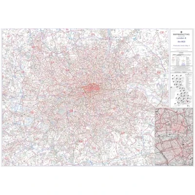
Sector Sheet 8 is a comprehensive postcode sector map focused on London and the M25 area, providing detailed coverage essential for navigation and planning in this densely populated region. This map is one of 37 pre-defined sheets covering the UK at sector level, displaying the initial portion of postcodes and the first number of the second part, or inward code, at a scale of an inch to 2.4 miles, ensuring clarity and accuracy in representation. Geographically, the mapped area extends from Potters Bar in the north to Oxted in the south, and from Thurrock in the east to Slough in the west, encompassing key urban and suburban centers within the Greater London area and its surrounding regions. Updated with the latest information from the Royal Mail Postcode Update, this sector map reflects all recent postcode changes, ensuring relevance and precision in addressing and location-based services. The map's specifications include dimensions of 73 x 107 cm (29 x 42 inches) and a scale of 1:60,000 (1 inch to 1 mile), providing users with a detailed and comprehensive overview of the area, facilitating effective decision-making and navigation.


Compare webshops (1)
Sector Sheet 8 is a comprehensive postcode sector map focused on London and the M25 area, providing detailed coverage essential for navigation and planning in this densely populated region. This map is one of 37 pre-defined sheets covering the UK at sector level, displaying the initial portion of postcodes and the first number of the second part, or inward code, at a scale of an inch to 2.4 miles, ensuring clarity and accuracy in representation. Geographically, the mapped area extends from Potters Bar in the north to Oxted in the south, and from Thurrock in the east to Slough in the west, encompassing key urban and suburban centers within the Greater London area and its surrounding regions. Updated with the latest information from the Royal Mail Postcode Update, this sector map reflects all recent postcode changes, ensuring relevance and precision in addressing and location-based services. The map's specifications include dimensions of 73 x 107 cm (29 x 42 inches) and a scale of 1:60,000 (1 inch to 1 mile), providing users with a detailed and comprehensive overview of the area, facilitating effective decision-making and navigation.
 Product specifications
 Price History
 Related products
 To Shop


